Due to the COVID-19 pandemic, all our offices are operating on a skeleton workforce. For inquiries, please get in touch with us via the emails listed on our contact page.
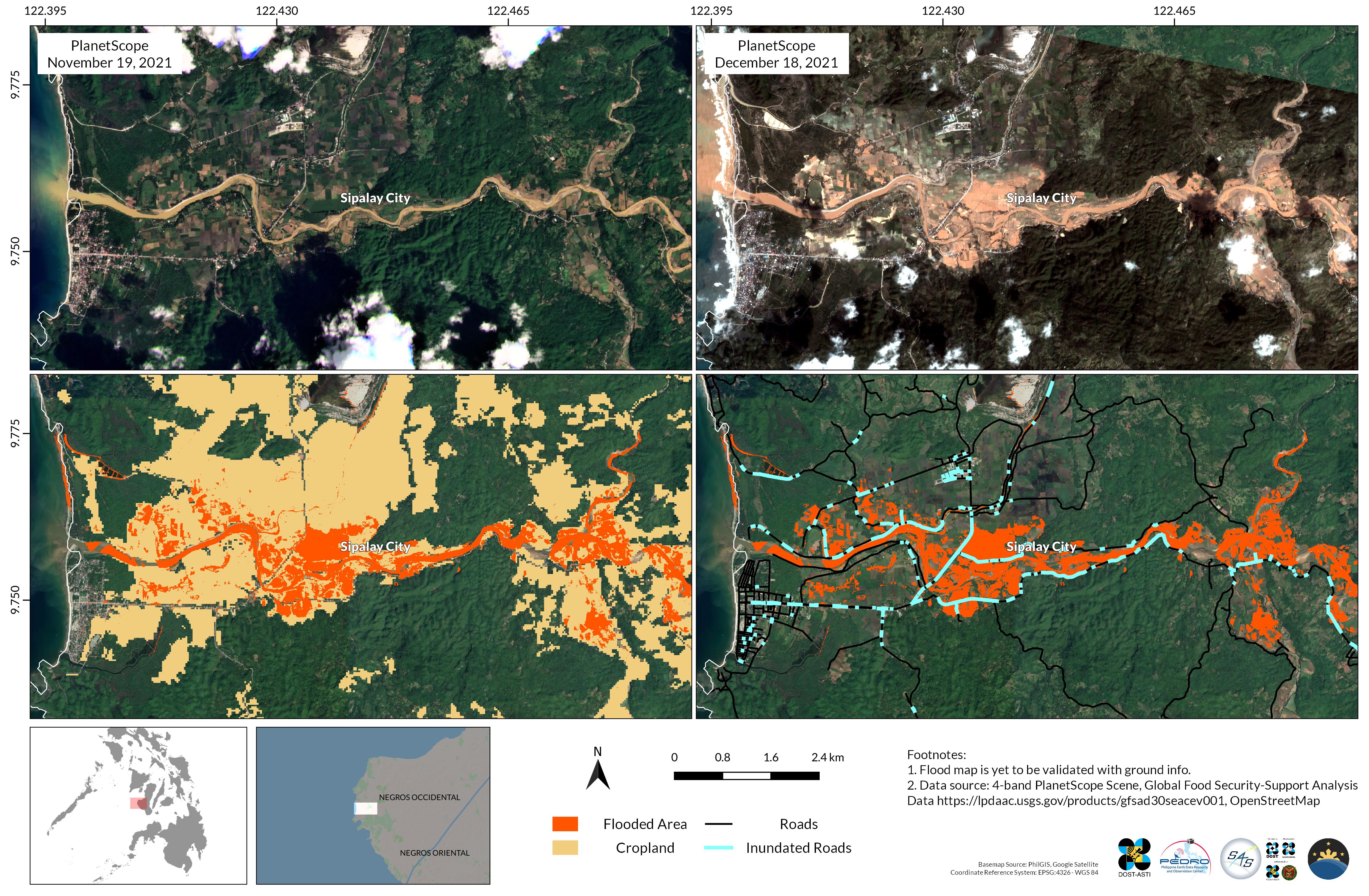
Researchers from the STAMINA4Space Program, DOST-ASTI and PhilSA closely monitored the Typhoon Odette, generating maps of the affected areas to provide near real-time data and information to government agencies and... Read more
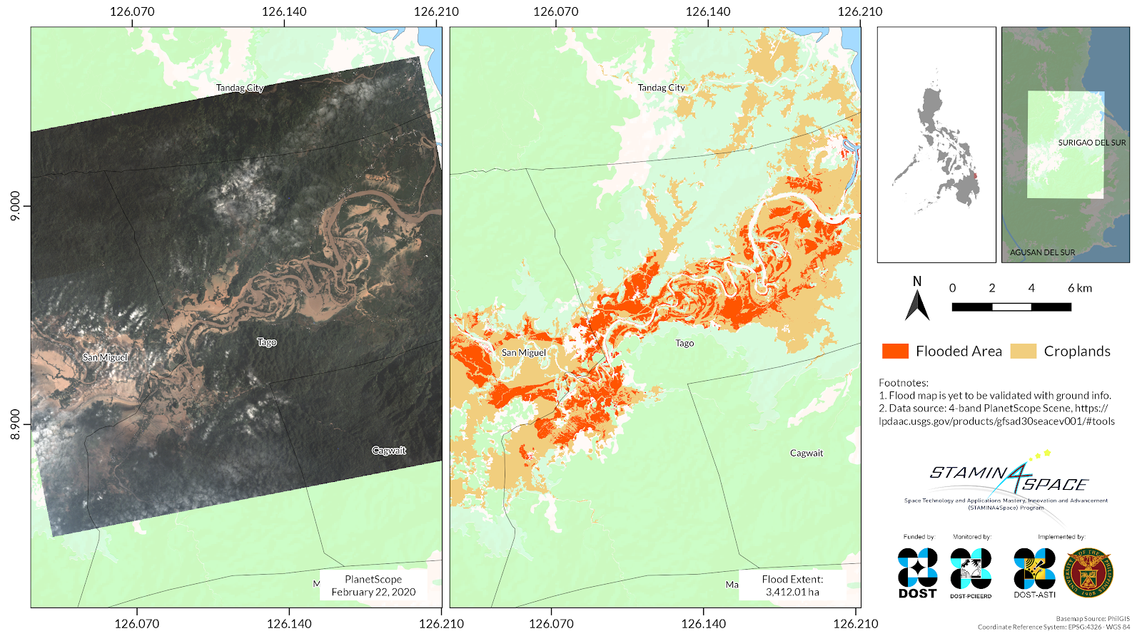
Approximately 3,168 hectares of croplands in San Miguel and Tago, Surigao del Sur were flooded due to Severe Tropical Storm (STS) Auring (international name: Dujuan), according to maps processed by... Read more
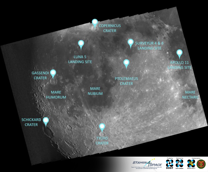
Moon serves as useful reference point in target pointing and calibration experiments As a scientific Earth Observation satellite, Diwata-2’s primary task is to capture images of Earth but it can... Read more