

Diwata-2 has successfully captured images, less than a month after its launch. Among the images captured include a portion of the Earth and some parts of the Philippines’ Aurora and Kalinga provinces. These images are part of the initial tests and calibration phase of Diwata-2’s cameras.
Having a sun-synchronous orbit will enable the microsatellite to have fixed revisit intervals — a vital feature that allows for repeated monitoring of targeted areas for assessment of crops, coastal areas and on demand image acquisition on areas hit by disasters. Its higher altitude (initial altitude at 621 km) also enables a longer lifespan. Diwata-2 will stay in orbit for 3 to 5 years, making it potentially last longer than Diwata-1.
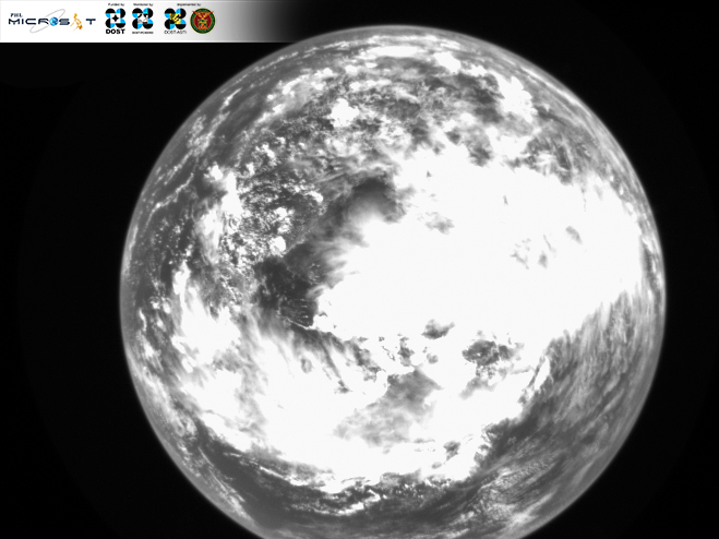
Diwata-2’s first vision of the Earth
The image of the Earth above was captured using Diwata-2’s Wide Field Camera (WFC) taken on November 6, 2018, at 1:36 in the afternoon. Large cloud patterns seen in the image are situated above the South China Sea.
The fields of Kalinga

Diwata-2’s High Precision Telescope (HPT) captured an image of Tabuk City, Kalinga, which is part of the Cordillera Administrative Region (CAR)on November 14, 2018, 1:09 in the afternoon. The image shows the Barangay of Bulo and its rice paddies during the second harvest season (upper right corner of image). Diwata-2’s 11-day revisit at 8⁰ satellite tilt will enable the acquisition of several images within a cropping season. These will be useful in determining the stages of crops and estimating potential yield as well as assessing the damage brought by flooding, drought and other disasters.
A snapshot of Aurora

This image was captured using the Spaceborne Multispectral Imager (SMI). It covers a part of the Casiguran municipality in the Philippines’ Aurora province, as well as the coast along neighboring municipalities Dinalungan and Dipaculao (sparsely obscured with clouds), Baler Bay and the Casiguran Sound. Images of coasts captured through Diwata-2’s cameras can be used to assess coastal conditions which are key indicators for water quality, ecological health and resource management.
Read more about Diwata-2 or browse, download and request for Diwata-2 images.