
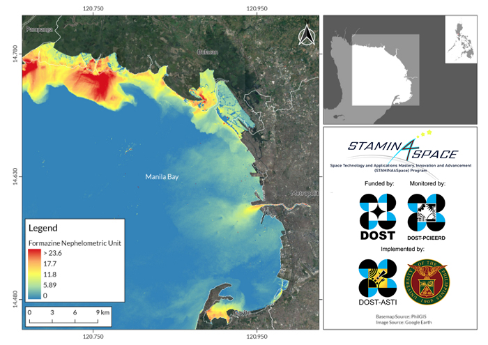
This map shows that the extent of water pollution extends inland, which may point to the built-up areas inside the river as a source of pollutants. This means that residential and industrial runoffs, such as wastewater from factories, are dumped onto the river. It is important to note that for the successful long-term rehabilitation of Manila Bay, the sources of pollution that enter the river, as well as other river systems that drain to the bay, should be identified and regulated as well.
Follow us