
On October 29, 2020, Filipino-made microsatellite Diwata-2 marked its second year in orbit.
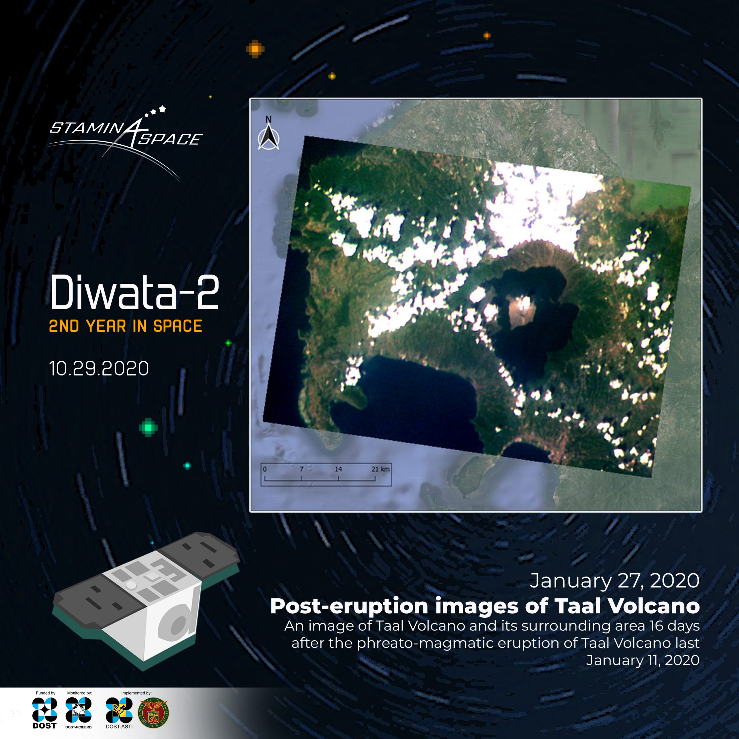
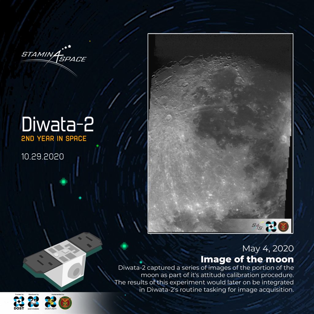
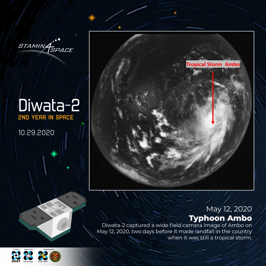
In its two-year journey, Diwata-2 allowed us to take a peek through a typhoon, provided clues on the extent of Taal volcano’s ashfall, and even took us on a quick sight-seeing trip to the moon.
Diwata-2 has already acquired 19,439 images of the Philippines, spanning 82.01% of the country. Globally, Diwata-2 has captured 32,256 images. These images are part of the data being collected to conduct scientific measurements and experiments for environmental assessment and monitoring.
“Diwata-2 has already covered twice as much half the time than its predecessor, Diwata-1. This is mainly due to its sun-synchronous orbit, allowing more frequent revisits and improvements made in pointing accuracy and mission operations from the ground,” said Space Technology and Applications Mastery, Innovation and Advancement (STAMINA4Space) Program Leader Dr. Gay Jane Perez.
Diwata-2 is a 50-kilogram Earth observation satellite developed by a team of scientists and engineers from the University of the Philippines Diliman (UPD) and the Department of Science and Technology-Advanced Science and Technology Institute (DOST-ASTI), in cooperation with Tohoku University and Hokkaido University in Japan. Diwata-2 is the third Filipino-made satellite that has been sent to space, following the 50-kg microsatellite Diwata-1 (deployed to space April 27, 2016), and the 1-kg nanosatellite Maya-1 (deployed to space on June 29, 2018). Diwata-2 was launched into space via an H-IIA F40 rocket on October 29, 2018.
To mark this important milestone, the STAMINA4Space Program has organized a virtual tour highlighting Diwata-2’s features and latest developments. Nearly 50 space enthusiasts have joined the sessions while over 200 have expressed their interest in the event.
The pandemic did not stop the researchers from conducting experiments to further enhance the capabilities of Diwata-2. In fact, researchers working on Diwata-2 were able to optimize image download from the satellite to the Ground Receiving Stations, marking the start of a faster turnover rate of images from acquisition to processing. They were also able to improve the target pointing capabilities of the microsatellite after a successful experiment using the moon as a reference point.
using High Precision Telescope (HPT)
Like how Diwata-2 built upon the learnings from Diwata-1, Diwata-2 is paving the way for the development of a more robust microsatellite, a testament to the continuous advancement of space research and development in the country.
“Moving forward, we also see Diwata to continuously serve as a seedbed to nurture growth in space science and engineering in our country through research and capacity building in satellite technologies and relevant space systems for the benefit of the society,” said Perez.
Diwata-2 has proven that Filipinos are capable not only of owning and operating satellites, but owning and developing them.
“Prior efforts in space science technology applications in the country such as the development, launch and operation of Diwata-2 help produce strategic know-how, vital infrastructure and skilled manpower,” said the Philippine Space Agency Director General Dr. Joel Joseph S. Marciano, Jr.
“The Philippine Space Agency welcomes the challenge and opportunity to institutionalize and operationalize the various space science technology applications initiatives towards sustained productivity and socioeconomic benefit for the country,” Marciano added.
Diwata-2 flies at an altitude of 605 km above sea level at the speed of 7.5 km per second in a sun-synchronous orbit. Diwata-2 is expected to serve the country for another three years.
Read more about Diwata-2 here.