
New study shows higher precision towards enabling better forecasts of localized extreme weather events
Using Diwata-1’s images, researchers were able to estimate the height of a cloud top, which is relevant in monitoring rainfall and thunderstorms.
This is according to a study published in the international journal Scientific Reports on May 5, 2020. The study, with a title “Determination of Cloud-top Height through Three-dimensional Cloud Reconstruction using DIWATA-1 Data”, highlighted the use of data from Diwata-1 in determining cloud-top height.
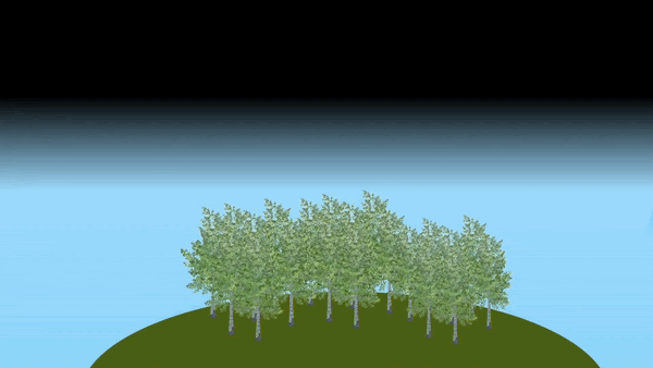
The height of a cloud-top, which is the distance between the top-most visible portion of a cloud and the Earth’s surface, is important in estimating the vertical growth of clouds. A faster rate of vertical growth of clouds often indicates rainfall and thunderstorms.
The study is a collaborative research among scientists from University of the Philippines Diliman (UP Diliman), Department of Science and Technology (DOST), Hokkaido University in Japan and Understanding Lightning And Thunderstorms For Extreme Weather Monitoring And Information Sharing (ULAT) Project. The ULAT Project is done through a Collaborative Research Agreement (CRA) with Japan International Cooperation Agency (JICA), Japan Science and Technology (JST) and Hokkaido University enjoining all parties for a project titled “Development of Extreme Weather Monitoring and Information Sharing System in the Philippines”. The project is an Official Development Assisted (ODA) project under the initiative of Japan’s Science and Technology Research Partnership for Sustainable Development (SATREPS) Program.
“This study is a demonstration that a single microsatellite, such as DIWATA-1, with its target-locking mode, can be used to obtain cloud-top height estimates at a higher temporal and vertical spatial resolution than conventional satellites. Since microsatellites are much cheaper to build and can be developed faster, the realization of its operational use for weather forecasting can be achieved with a constellation of microsatellites and denser ground receiving stations,” said STAMINA4Space Program Leader Dr. Gay Jane Perez.
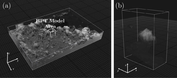
Using the satellite’s target-locking capability that could capture cloud images at 200-ms interval and its high resolution payloads, researchers constructed three-dimensional cloud models. These images have finer vertical resolution than other satellite data, allowing more precise measurements.
Diwata-1’s mode of capturing
Normally, earth-observation satellites such as Diwata-1 and Diwata-2 capture images by facing their cameras or sensors towards the Earth’s surface. This is shown in Figure 1 where the satellite continues to take pictures with the same orientation as it moves along its orbit. This is called nadir-pointing and produces a bird’s-eye view of the surface.
In this study, Diwata-1 employs a different imaging technique called target-locking mode which can be seen in Figure 2. The target-locking mode is where a satellite reorients itself as it captures images of a specific target, in this case, clouds. This allows Diwata-1 to capture images of the same cloud at different angles. With these sets of images at hand, a technique called stereo-imaging can be used to produce a reconstructed 3D model of the cloud.
What is a cloud-top height for?
For this study, Diwata-1’s high resolution cameras like the Spaceborne-Multispectral Imager (SMI) and the High-Precision Telescope (HPT) were used, allowing for higher image resolution. The precision of the 3D model and its measurements, shown in Figure 4, relies on the resolution of the images. Due to the relatively finer resolution of DIWATA-1’s cameras, a more precise measurement of cloud-top heights can be achieved.
In particular, using images captured by Diwata-1’s HPT and SMI cameras, cloud-top height measurements at 2-m or 40-m resolution can be obtained, which are 250 and 12.5 times, respectively, finer than currently available data on cloud-top heights derived from other satellites and techniques.
“The vertical resolution provided by Diwata-1 is indeed higher than conventional satellites, only measurements provided by emitting lasers could produce a higher vertical resolution. However, these instruments are limited and only provide measurements below their track. Furthermore, they are technologically expensive and complex. By using a microsatellite, greater aerial coverage can be achieved.” said Ellison Castro, researcher and one of the authors of the paper.
But where can these measurements be used?
These measurements are used in estimating the vertical growth of clouds. A faster rate of vertical cloud growth can indicate heavy rainfalls. This is especially helpful in tropical countries such as the Philippines. During the dry months of April to June, intense heat experienced during the day contributes to an increase in the convective activity of the atmosphere, enabling the development of thunderstorm clouds that may bring isolated heavy rains.
Monitoring the cloud-top height may be used as an input to an early warning system and forecast methodologies, further equipping us for weather disturbances.
In April 6, 2020, Diwata-1 reentered the Earth’s atmosphere, ending its four-year service to the country. With this, Diwata-1’s estimation of cloud-top height continues with Diwata-2, having been equipped with similar HPT and SMI cameras.
See the full paper here: www.nature.com/articles/s41598-020-64274-z
Read more about Diwata-1 or browse, download, or request for images.