

January 6, 2020 January 27, 2020
Remote sensing experts from the Space Technology and Applications Mastery, Innovation and Advancement (STAMINA4Space) Program acquired a new Diwata-2 image of Taal Volcano, a few weeks after the January 12 eruption.
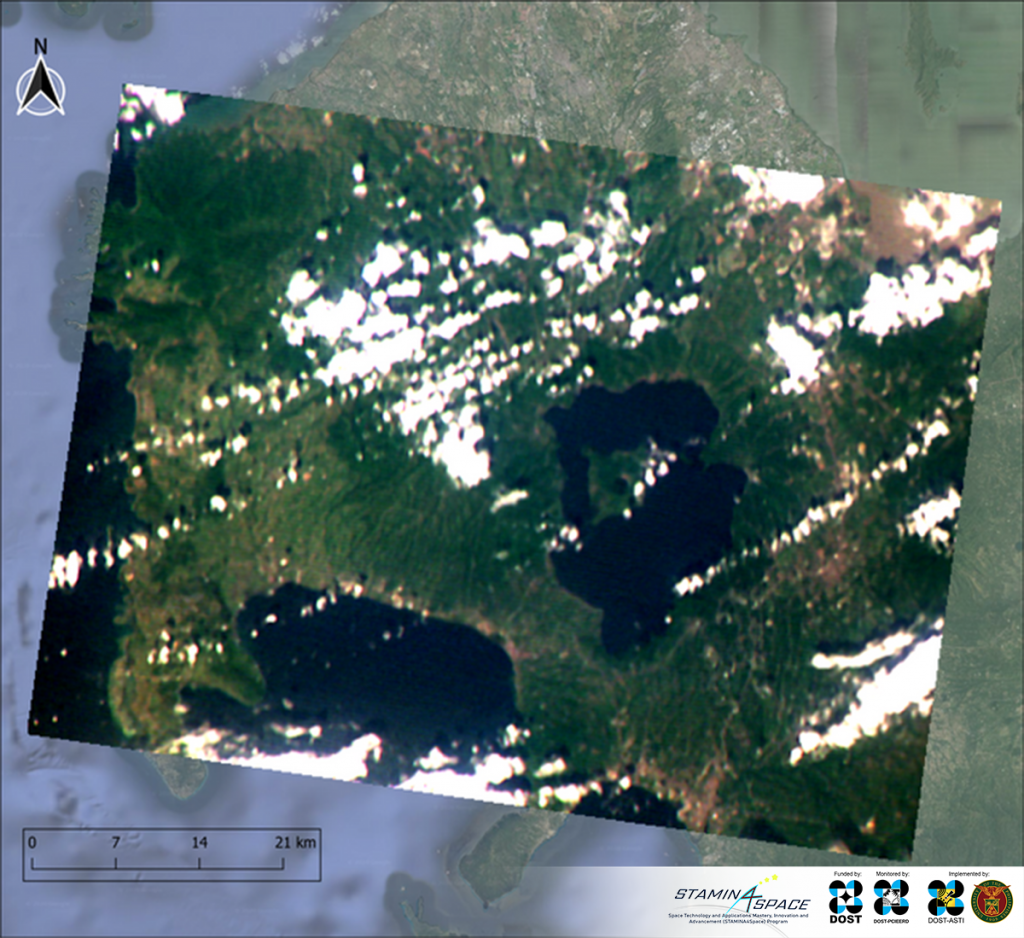
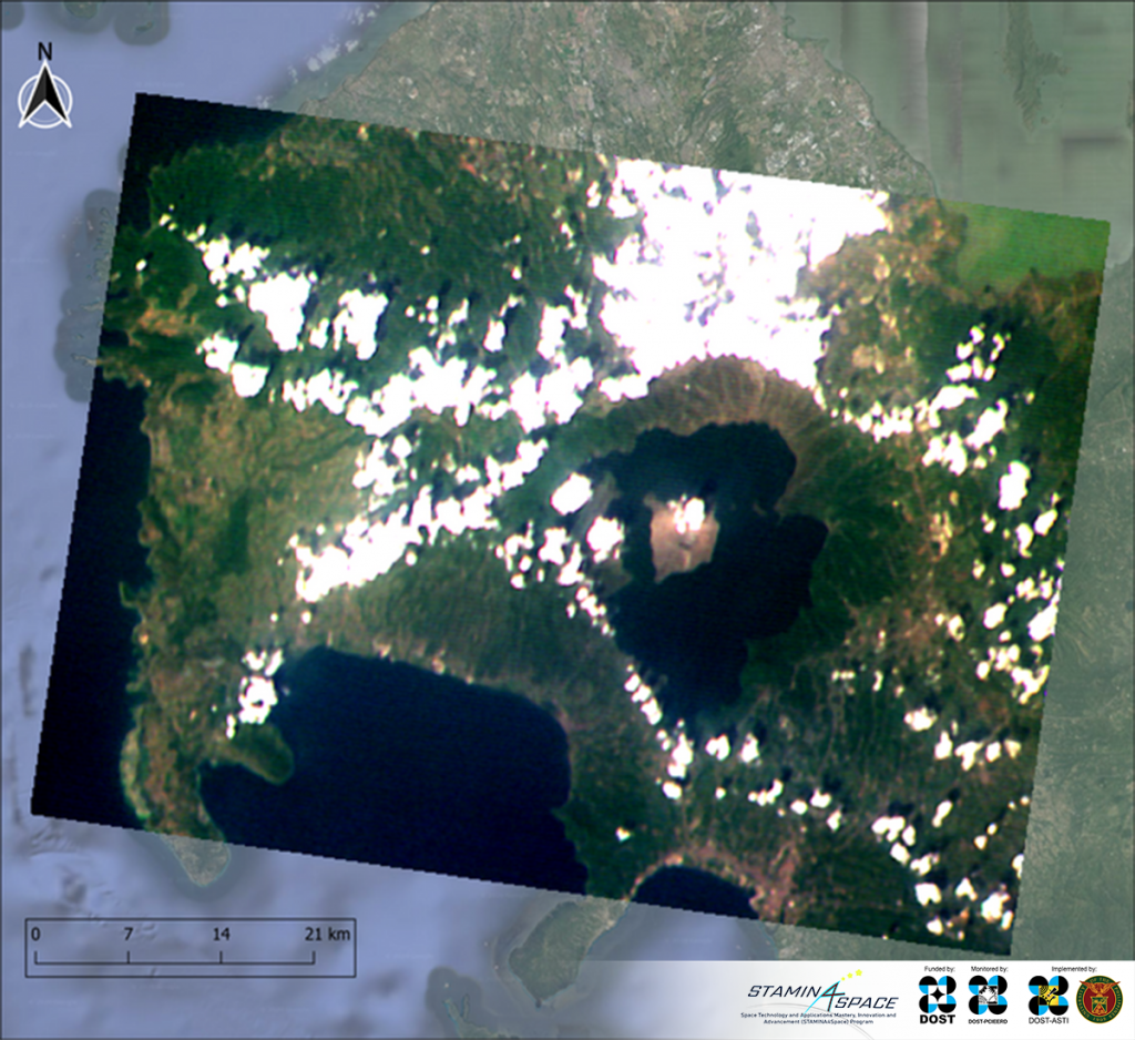
The image was captured by Philippine microsatellite Diwata-2’s Spaceborne Multispectral Imager (SMI) on January 27, 2020, 16 days after the phreato-magmatic eruption of Taal Volcano. To detect changes, it was compared to a pre-eruption image captured on January 6, 2020. Figure 1 shows the January 6 image (left), side-by-side with the post-eruption January 27 image (right). The SMI is one of the five optical payloads or cameras on-board the Earth-observing microsatellite.
Since the onset of the eruption, Diwata-2 has been tasked to capture images of the affected area — maximizing the microsatellite’s sun-synchronous orbit, which allows the team on the ground to calculate regular revisit times of 11 days over a targeted area. An image where Taal is visible was successfully captured on January 27.

Supplementary data for determining ashfall
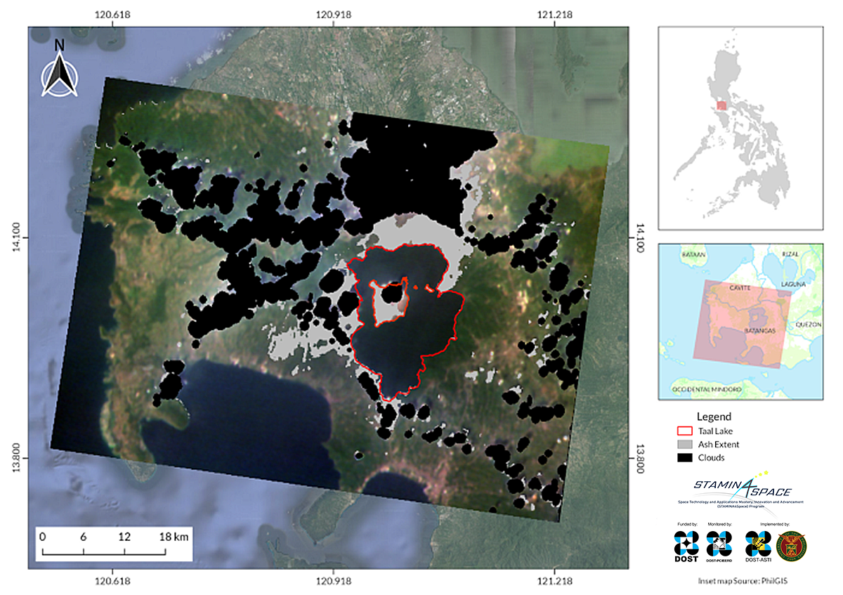
Comparisons between pre-eruption and post-eruption images show ash covering Taal Volcano Island and mainland around Taal Lake. These images allowed researchers from the team to make an assessment on the extent of ashfall after the eruption. In Figure 2, areas possibly affected by the ashfall were shaded in gray.
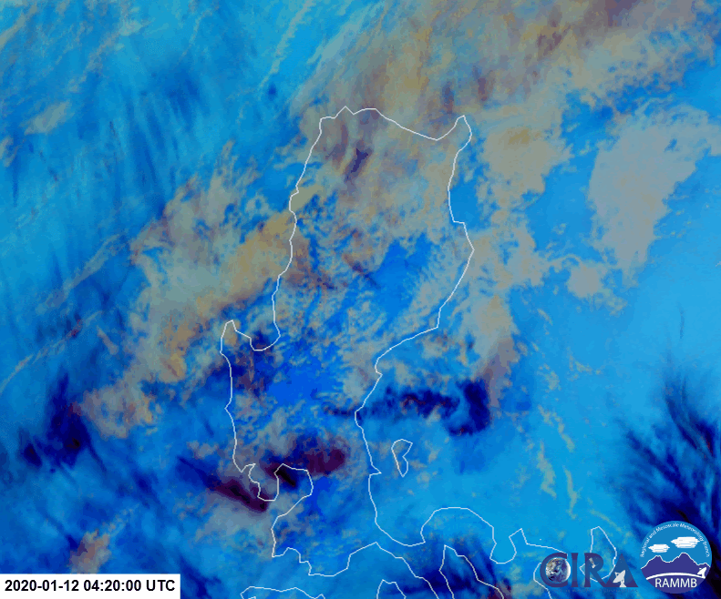
Aside from Diwata images, data from other satellites were also studied. Images from space during the eruption show the extent of ash clouds up to the Cagayan Region, approximately 380 kilometers north of Taal, Batangas. Figure 3 shows the concentration of ash in the atmosphere, with dark red colors depicting higher ash concentration. Although the ash clouds reached Northern Luzon, ash fall was only recorded as far as Pampanga and Pangasinan. This is due to the characteristics of the ejected volcanic material and atmospheric processes involved in their transport.

The extent of the area affected by the ash fall depends largely on the following factors: the volume and particle size of ash erupted, height of volcanic plume, atmospheric moisture, wind speed, and wind direction. Heavier and coarser volcanic ash particles are more likely to land in close to the crater due to gravity, as opposed to lighter and finer particles that are more likely to get dispersed farther.
Environmental impacts of the eruption
Aside from monitoring the extent of the ash clouds, satellites also detected the diffusion of toxic compound sulfur dioxide in the atmosphere due to the eruption. Areas in darker orange (Figure 4) indicate higher presence of sulfur dioxide in the atmosphere.
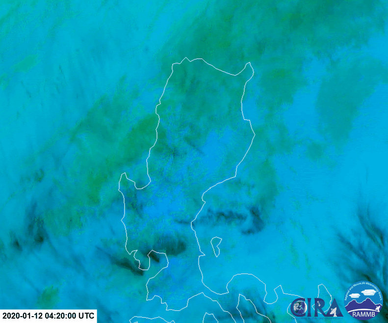
Sulfur dioxide is a toxic gas that can cause irritation of the eyes, skin, and airways. This compound can also be converted to acid rain which disrupts photosynthesis in plants and contaminates water. Water in contact with sulfur dioxide makes it acidic and such an environment is known to alter fish respiration and behavior such as reproduction. Some fish species produce fewer eggs in acidic environments, which could affect the population of fish.
Spaceborne solutions for Earth problems
This information would not be possible to obtain without earth-observation satellites. The advantageous vantage point of space provides us with more opportunities for large-scale assessments of geologic and atmospheric phenomena such as volcanic eruptions. With the continuous development of spaceborne technology, we hope to tap into more possibilities on integrating data collected from space and the ground.
References:
¹ SEVIRI Ash RGB Quick Guide. https://www.eumetsat.int/website/wcm/idc/idcplg?IdcService=GET_FILE&dDocName=PDF_RGB_QUICK_GUIDE_ASH&RevisionSelectionMethod=LatestReleased&Rendition=Web
Learn more about Diwata-2 or browse, download, or request for Diwata-2 images.